Before I built a wall I’d ask to know
Robert Frost, Mending Wall
What I was walling in or walling out,
And to whom I was like to give offense.
This follows the last post, Outlines and Outlines, the meandering pre-thoughts of some of the ideas underpinning my work. As mentioned previously, I am playing catch-up here for a while, the work being made now has moved on and has different and deeper concepts as I will write about in time.
From early consciousness the idea of boundaries and territories has intrigued me. I have a fascination with maps and their virtual and digital iterations, and the actual land and geography is intriguing. As mentioned previously, the manner in which it has been carved up and demarcated occupies my mind. As I turn my focus to the national boundary, I think back to my indignation as a child (that persists) at the notion that I might be granted or denied access to another place on the globe by virtue of where I happened to have been born. With maturity came the cognisance of the actual significance of this situation and the realisation of the implications of a random birthplace in the world (speaking from the point of view of a particular consciousness inserted into a body somewhere, haha, not a generational selection of where one, or one’s children may happen to inhabit). The significance of this situation is well described below in the words of Adekunle Ajala1:
“… the location of one boundary may determine for millions of people the language and the ideas which their children would be taught at school, the books and newspapers they would be able to buy, and the kind of money they would use, the markets in which they would buy and sell and even sometimes the kinds of food they might be permitted to eat. Besides, it determines their national culture with which they shall be identified, the army in which they might serve and also the soil which they might be called upon to defend with their lives, whether or not they choose to defend it.”
Within the boundaries, the socio-economic/political aspects have been part of my work for a while, but so too the other aspect that Ajala points to, the actual relationship of an individual with the land – or, as he describes, the soil. It seems that when the first goes rotten, there is less possibility for the latter to emerge, or perhaps that is a myopic view. It may be that when the structures crumble, there is only the relationship between the individual and their land, but that is subject to the prevailing conditions. Or maybe I am just radically over-simplifying the whole scenario, which is more likely. It is worth noting that Ajala’s text above is dated 1983, at which point the globalisation we currently experience was unlikely to have been conceived of – the manner in which the boundaries in question have changed has been radical in this regard and informs later work.
Little expresses the impact of these forces on both individual and groups of people more clearly than the global migration crisis we have witnessed over the past few years. For millions of people, not only “a better life”, but simple survival has meant a move (or attempted move) from one bordered territory to another, sometimes with costs so extreme they can barely be comprehended. Closer to home is our own migration and diaspora story, which whilst does not seem to embody the level of desperation seen elsewhere, undoubtedly includes stories which would fill one with horror or heartbreak. My own deliberations regarding where and how I should live and the extent to which these affect me seem considerably trite in relation, and it is with caution and sensitivity that I approach these ideas. Where to position my viewpoint, and how to interrogate things in a personal and informed manner, I think is one of my biggest challenges as I go forwards.
It was against this broad backdrop that I turned my consciousness to the boundaries of Zimbabwe. Like most people have done, I have often looked at the nature of the shape and wondered how it came to be, why there are straight lines, who decided it should follow the river or the mountains in some parts, and why there is that curious semi-circle shape in the southern boundary. Judy Best and Lovemore Zinyama2 have written about the drawing and evolution of the boundary in considerable detail and I have loved reading their work. They note that by the end of 1891, the broad conception of the modern boundary was drawn, though it is clear that as the BSAC unrolled their occupation under the 1889 Royal Charter, the limits of their claim was at best vague. The Charter authorised the company to operate in “the region of South Africa lying immediately to the north of British Bechuanaland, and to the north and west of the South African Republic, and to the west of the Portuguese Dominions” (Best and Zinyama 1985:1). The northern limits were initially left deliberately vague, but over the following years were established. The boundary emerged as a line demarcating a claim on a land by people who did not belong there, who had no right to the wealth of those territories.
They took no notice of how, what or who this line divided, they made a line to safeguard their loot from their accomplices. They paid little heed to the fact that the drawing of this line was a violence imparted on the land and its inhabitants. Their ignorance and callousness is clearly expressed by the well known quote of Lord Salisbury in 1906: “We have been engaged in drawing lines upon maps where no white man’s foot ever trod; we have been giving away mountains and rivers and lakes to each other, only hindered by the small impediment that we never knew exactly where the mountains and rivers were”. One of the works made to date deals with the idea of the line as violence, it will be exhibited within the coming weeks and I will write about it then. Here is a detail in the meantime.

If I possessed a sense of indignation about my conditions, it is of absolutely zero significance when compared to what must have been the outrage and disbelief of the inhabitants of the southern African territories that were to become demarcated, stolen and claimed through combinations of force and deceit in the years that followed. It is only with bewilderment that I think of this from my 2021 perspective – no words that come to mind can possibly come close to describing what transpired. More importantly, whilst I am part of this ongoing story, to speak on behalf of others in this regard would constitute not only more arrogance, but another theft; it is not my intention to speak where my voice does not belong.
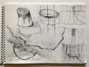
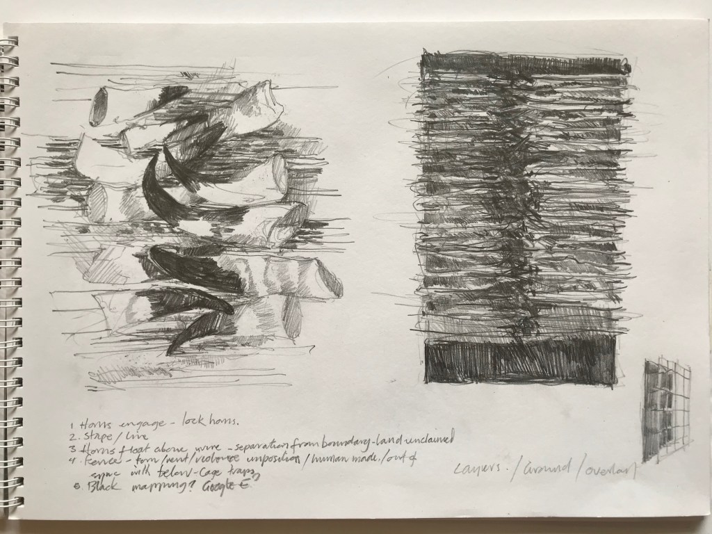
The colonial enterprise in all its vileness is well documented and we are all part of an ongoing process of facing its consequences. Whilst I hope that my work contributes in some way to this process, it is not my primary intention. My main interest lies with the boundaries themselves, their nature as obstacles, markers and indeed passages. A few sketchbook pages are included below as conclusion.


Greg Shaw,
14 April, 2021
- Ajala, A. 1983. Africa Spectrum: “The Nature of African Boundaries”. Africa Spectrum , 1983, Vol. 18, No. 2 (1983), pp. 177-189. Sage Publications, Ltd. [O]: Available at: https://www.jstor.org/stable/40174114 (Accessed 10 February 2021).
- Best, J. and L.M. Zinyama, 1985. Journal of Historical Geography: “The Evolution of the National Boundary of Zimbabwe” (p419-432) [O]. Available at: https://www.sciencedirect.com/science/article/abs/pii/S0305748885801018 (Accessed 2 February 2021).

Leave a comment